
@juergen_hubert@mementomori.social
·
Jun 09, 2026
Jürgen Hubert
@juergen_hubert@mementomori.social
Translates German folk tales. Tries to learn #Italian . #ttrpg #pnpde #dnd #folklore
mementomori.social
I've looked at quite a few #OpenStreetMap tile servers in the last week, and the various approaches for displaying map information are deeply fascinating.
If I had infinite money, I would hire someone to create a tile server which uses the map iconography of 19th century maps (but using modern map information). That would be a great match for my interactive folklore maps!
7
0
5
#MagicEarth hat ein neues Update veröffentlicht.
Android Auto: Favoriten, eigene POIs & Kartenebenen vom Handy synchronisiert; neue Höhen- und Satelliten-Stile; Sprachnavigation unterstützt.Schnellere App, weniger Akkuverbrauch.Neu gestalteter Einstellungen-Tab.Koordinatensuche behoben; Adressen & Koordinaten auswählbar.Import-Buttons für Favoriten & Verlauf.Kauf wiederherstellen für Google Play.Landschaftliche Routen für LKW.Fehlerbehebungen und Stabilitätsverbesserungen.
Version 7.1.26.21
#OpenStreetMap #navigation
0
0
0
Dank #OpenStreetMap bin ich gerne mindestens 15 Minuten früher an Treffpunkten. Vor allem dort, wo ich noch nicht so oft war. Vor Ort nutze ich gerne Vespucci, da ich damit so ziemlich alles eintragen kann. Soll es schneller gehen, oder wenn ich irgendwo zu Fuß unterwegs bin, nutze ich #StreetComplete. Mit #Baba mache ich Fotos für #Panoramax.
Fahrt ihr zu zweit, lasst ruhig jemand anderen fahren. Das nutze ich dann als Beifahrer um zu mappen. In StreetComplete habe ich ein extra Aufgabenprofil erstellt, welches nur bestimmte Aufgaben anzeigt, welche auch während der Fahrt eingetragen werden können.
0
3
0

@nicd@masto.ahlcode.fi
·
May 04, 2026
Nicd
@nicd@masto.ahlcode.fi
Fool's stack / full snack software developer from #Tampere, Finland. Average #Elixir and #Gleam enjoyer. Admin of @code_stats. Year-round cyclist. I self host my instance, please be patient with it. #cycling --- Softasorvaaja Tampereelta. Keskiverto Elixir/Gleam nautiskelija. Pyöritän mm. @code_stats. Ympärivuotinen pyöräilijä. Tämä instanssi pyörii omalla purkilla, olethan kärsivällinen. #pyöräily
masto.ahlcode.fi
In OpenStreetMap how do I mark a removed pedestrian bridge? The ends are still there but the bridge is not and there is a sign that the bridge has been removed from use (no information on if it's temporary or permanent).
abandoned=yes or remove the entire path?
#OpenStreetMap
3
9
3
@OSMIndia@en.osm.town
·
Apr 09, 2026
OpenStreetMap India
@OSMIndia@en.osm.town
Volunteer community of Indian citizens. Together, we make a freedom-respecting map of India. Regional event hashtags Delhi - #OsmNcr Mumbai - #OsmMumbai West Bengal - #OsmWb Lucknow - #OsmLucknow pan-India remote/hybrid events - #OsmIndia
en.osm.town
The #OpenStreetMap community of #Delhi invites everyone to its 28th mapping party!
#Meerut needs our mapping help, and we're answering the call.
🗓️ Sunday, 12th of April
🕙 4 PM to 7 PM, followed by refreshments (sponsored by #TomTom)
📌 Haldiram's, Garh Road, Meerut
Learn more, register, and add the event to your calendar at - https://osmcal.org/event/4349/
#PleaseBoost #OsmNcr #OSM #India
4
1
6
@OSMIndia@en.osm.town
·
Apr 29, 2026
OpenStreetMap India
@OSMIndia@en.osm.town
Volunteer community of Indian citizens. Together, we make a freedom-respecting map of India. Regional event hashtags Delhi - #OsmNcr Mumbai - #OsmMumbai West Bengal - #OsmWb Lucknow - #OsmLucknow pan-India remote/hybrid events - #OsmIndia
en.osm.town
Thanks to all 5 participants of the 28th OpenStreetMap Delhi Mapping Party!
During the party, 231 features were created across 20 changesets. These include -
50 amenities
47 shops
39 streets
31 buildings
16 healthcare
10 man-made
10 offices
7 public transport
7 tourism
6 landuse
And that's excluding the mapping on the way from Delhi to Meerut and back!
#OpenStreetMap #OSM #OsmNcr #Delhi #Meerut #India
17
2
8

@arra@kolektiva.social
·
Apr 29, 2026
Association ARRA
@arra@kolektiva.social
Association pour la Réduction des Risques Aéroportés Pour l'auto-organisation et l'#AutodéfenseSanitaire contre le covid Vulgarisation - Prêt de purificateur - Distributions de masques - Mutualisation de moyens #CovidIsAirbone #CovidIsNotOver #MaskUp
kolektiva.social
La carte des lieux de vaccination a été mise à jour !
https://vaccins-covid.gogocarto.fr/map#/carte/@45.569,5.384,12z?cat=all
Les données des anciennes campagnes apparaissent en vert clair, vous pouvez les consulter pour savoir où vous renseigner
Il y a peu de nouvelles données pour l'instant, pensez à indiquer les infos que vous avez sur la carte, elle est collaborative, sans vous, rien n'existe 💚
#Vaccin
#CovidIsNotOver
#Carte
#CarteCollaborative
#OpenStreetMap
9
7
31

@tomminieminen@mastodontti.fi
·
Apr 23, 2026
Tommi Nieminen
@tomminieminen@mastodontti.fi
Staunchly Peircean pragmaticist linguist, phonetician and semiotician. Does translation studies and comparative literature too when time allows. Politically far left, deal with it. Localizes FOSS (eg. KDE Plasma, Vivaldi browser, Handbrake media transcriber). Writes linguistics articles to Finnish Wikipedia when time allows.
mastodontti.fi
Suunnistin #OpenStreetMap'in perusteella #Citymarket'iin Lahdessa. En päässyt perille. #GoogleMaps sen sijaan on jo päivittänyt sijainnin, vaikkei sekään vielä piirrä liikettä kartalle. #kartta #Lahti
4
2
2

@veganguide@veganism.social
·
Apr 21, 2026
vredt svin
@veganguide@veganism.social
find veganske steder https://theliberationpledge.com/map/
veganism.social
💚🐮 På #HappyCow kan du let se hvilke dyrplagerrestauranter, der også har #veganske valgmuligheder.
💢🐷 Men har du givet #AngryPig et kig? Et verdenskort over helt #veganske steder. Et #OpenSource kort baseret på #OpenStreetMap.
https://theliberationpledge.com/map/
🌱💳 Det er vigtigt at støtte #veganske virksomheder, hvor #veganere kan arbejde uden at skulle stege lig på bestilling.
🍴🍖 Tag #LiberationPledge i dag og sig #nej til spisebord fyldt med #dyremishandling.
3
0
4


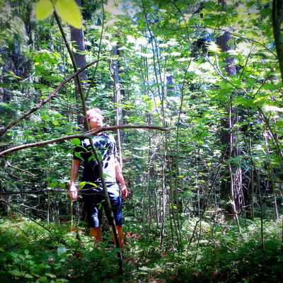
@stevefaeembra@mapstodon.space
·
Apr 22, 2026
stevefaeembra
@stevefaeembra@mapstodon.space
steve / fae / embra Steve from Edinburgh. I'm a Web developer, coder and cartographer, based in Edinburgh, Scotland. Mostly map-like things using QGIS, Blender and other FOSS.
mapstodon.space
Following the route up Ben Nevis. Rendered in #Blender from data copyright #OpenStreetMap contributors, and OS Open ZoomStack crown copyright and database rights
DEM derived by TIN gridding contour lines in #QGIS
15
0
10


@CoMaps@floss.social
·
Apr 15, 2026
CoMaps - Hike, Bike, Drive
@CoMaps@floss.social
Navigate with Privacy - Discover more of your journey - Powered by the community A community map navigation app. Easy and free offline navigation for travelers. • Transparency • Open Source • Community-first • Privacy-focused • Not-for-profit • Community funded
floss.social
We have recently received a trust score by 9.6 out of 10 from "European & Open Source Alternatives", a website that wants to help people find trustworthy alternatives to Big Tech.
With that stellar rating, we are currently the top-rated alternative in the Maps category, side-by-side with our friends from #OpenStreetMap ❤️
Check out how that score was calculated for us, and other map alternatives here: https://european-alternatives.cloud/en/browse?category=maps
263
4
188
@CoMaps@floss.social
·
Apr 10, 2026
CoMaps - Hike, Bike, Drive
@CoMaps@floss.social
Navigate with Privacy - Discover more of your journey - Powered by the community A community map navigation app. Easy and free offline navigation for travelers. • Transparency • Open Source • Community-first • Privacy-focused • Not-for-profit • Community funded
floss.social
Version 2026.04.07 is already out on Codeberg, F-Droid, iOS and Flatpak -and soon on Google Play too!
The update includes #OpenStreetMap data from April 5, brings a refreshed outdoor map style, displays if organic options are available in stores/restaurants/…, and localized road shields for more countries.
All changes are here: https://codeberg.org/comaps/comaps/releases/tag/v2026.04.07-8
130
4
57
@alison@burningboard.net
·
Apr 07, 2026
Alison Chaiken
@alison@burningboard.net
Ich bin in Philadelphia geboren und in USA aufgewachsen. Später arbeitete ich beim Bosch in Hildesheim und XSe in VIllingen-Schweningen. Von Februar 2026, beginne ich ein neues Leben in Berlin. Ich arbeite seit langem mit C++/C und Linux Betriebssystemprogrammierung. Außer Technik und Deutsch Studium sind Radfahren und Musik meine Leidenschaften.
burningboard.net
@Frau_Beckedahl@chaos.social @digiges@chaos.social @cbase@chaos.social @anneroth@systemli.social @kantorkel@23.social @pneutig@eupolicy.social
Es wäre schön, die Videoüberwachung in #openstreetmap zu verorten. Ich finde die nicht in Berlin.
0
2
1

@Binzy_Boi@humanwords.party
·
Apr 05, 2026
Binzy_Boi
@Binzy_Boi@humanwords.party
The local Albertan! Former Flashpoint Archive staff member. Enjoys local history, open data, Canadian politics, retro video games, and cooking (mmmm, perogies). Big fan of Osaka from Azumanga Daioh. Demisexual. #yyc #alberta #canada #demisexual
humanwords.party
For the last month, I've been working on mapping the town of Strathmore #Alberta in #OpenStreetMap . Happy to announce that, while addresses are still needing to be added, most if not all buildings in the town are now mapped.
8
0
1

@papuass@toot.lv
·
Feb 25, 2026
Mārtiņš Bruņenieks
@papuass@toot.lv
Ikdienā strādāju ar elektroniskajām skaitļošanas mašīnām. Pasists uz velosipēdiem un Vikipēdiju.
toot.lv
Vecrīgas novērošanas kameras: https://sunders.uber.space/?lat=56.94929562&lon=24.11031246&zoom=17'
#openstreetmap
0
0
1
MagicEarth hat ein Update erhalten!
Szenische Routenführung für angenehmere Fahrten hinzugefügtKostenlose Nutzer können jetzt ihre eigenen permanenten Straßensperren sehenRoutenreichweiten-Berechnungen korrigiertKoordinatensuche verbessertStabilität und Absturzberichte verbessertMehrere Abstürze und ANRs behoben, einschließlich einiger Android-Auto-Probleme
Play Store Link: MagicEarth
#OpenStreetMap #MagicEarth
0
0
1

@Edent__dup_2944@mastodon.social
·
Feb 14, 2026
Terence Eden
@Edent__dup_2944@mastodon.social
Longer hair than you. Got the ⏻ symbol into #Unicode. Open Standards / Source / Data geek. Known as @Edent on most social platforms. Bit obsessed with #SolarPower but not quite a #SolarPunk. Please read the link before replying. Yes, that means you!
mastodon.social
I think I've cracked it!
Using #OpenStreetMap as a custom OIDC provider in #Auth0. Which means people can log in to OpenBenches with their #OSM credentials via OAuth.
If you'd like to test it, please visit https://openbenches.org/login
(You don't need to upload a photo.)
32
8
13

@FreemapSlovakia@en.osm.town
·
Feb 18, 2026
Freemap Europe
@FreemapSlovakia@en.osm.town
NGO and Slovak Local Chapter of OpenStreetMap. Developers of the open-source outdoor map platform https://www.freemap.eu Detailed European outdoor maps, routing, GPX tools, terrain shading. Powered by OpenStreetMap data.
en.osm.town
Hello OSM community 👋
This is our first post here.
Freemap Slovakia is the Slovak Local Chapter of OpenStreetMap and we develop the open-source outdoor map platform https://www.freemap.eu focused on Europe.
Freemap.eu provides detailed outdoor rendering, terrain shading, route planning, GPX tools, rich POIs and minutely OSM updates.
We will share project news and technical updates here for a broader English-speaking audience.
#OpenStreetMap #OSM #FOSS #Cartography #GIS
11
0
9
@juergen_hubert@mementomori.social
·
Feb 13, 2026
Jürgen Hubert
@juergen_hubert@mementomori.social
Translates German folk tales. Tries to learn #Italian . #ttrpg #pnpde #dnd #folklore
mementomori.social
#WritersCoffeeClub Feb. 13: Do you use maps as reference materials as you write?
Constantly. I translate 19th century local legends, and most of these are tied to real world locations that can (or at least could) be visited. Researching and identifying these locations takes up a significant portion of the work I put into this project.
My main tools for this are #OpenStreetMap , Google Maps, and Arcanum Maps - the latter for its historical maps, as a lot of the place names used in these tales are no longer in use today.
I am also creating an interactive online map showcasing the locations I have been able to identify, and you can see it on the main page of my wiki:
https://wiki.sunkencastles.com/wiki/Main_Page
12
1
3